Mapping and Modeling Urban Heat in Baltimore
Project Partner: World Resources Institute, Spring 2024
Project Description: As climate change intensifies, extreme urban heat increasingly threatens human health and requires prioritized action and research to mitigate its harmful impacts. Accurate air temperature models are critical for informing equitable heat mitigation strategies and enhancing resilience to rising urban temperatures.
Leeza partnered with the World Resources Institute (WRI), on a project titled “Data for Cool Cities”, to improve the accuracy, transferability, and overall performance of an intra-city air model for accurate heat exposure mapping in diverse urban settings.
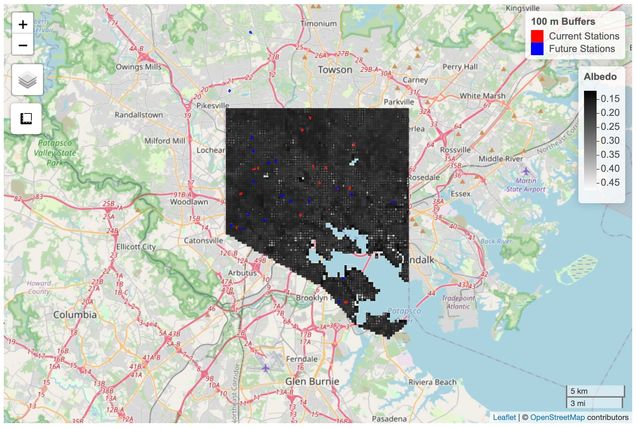
Leeza evaluated the suitability of regional air temperature sensor networks in Baltimore, MD for integration into the air temperature model and worked with a local Integrated Field Laboratory, the Baltimore Social-Environmental Collaborative (BSEC), to identify undersampled areas from the perspective of mapping and/or model evaluation. She created an interactive map tool for the BSEC team to aid in the selection process for new sensor locations. After the completion of her internship, she is continuing her collaboration with WRI and working on testing and improving the transferability of the model to different urban areas.
Project Deliverables:
- Two unified datasets (from Baltimore and Phoenix), assembled from regional sensor networks and locally-deployed sensors
- A report on:
- the suitability of each dataset for use in modeling work
- methods for cleaning and preprocessing each dataset
- requirements for future datasets that could be integrated into model
See Leeza’s URBAN Internship lightning talk here.

