Project Partner: Speak for the Trees, Boston, Summer 2020
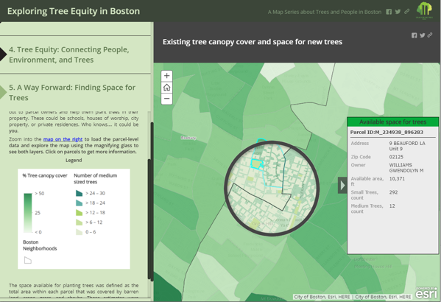
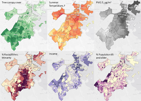
Project Summary: Urban trees make for healthy communities. In Boston, as in many cities, tree canopy is unequally distributed, such that some residents receive many health and environmental benefits while others receive very few. Raquel partnered with Speak for the Trees to identify areas in Boston where new trees could be planted in order to improve tree equity. She integrated remote sensing, land cover, and administrative data and accounted for available planting space, existing tree canopy, and neighborhood-level environmental and sociodemographic characteristics. Raquel created an interactive and publicly available online map that supports Speak for the Trees’ outreach and education efforts as well as targeted tree-planting initiatives aimed at both increasing tree canopy and reducing racial, ethnic, and socioeconomic disparities in access to benefits from urban trees.
Project Deliverables: Exploring tree equity in Boston: A Map Series about trees and people. Also see the Twitter campaign celebrating Raquel’s work by searching #TreeEquityBoston.