Data Record Specification
The GLanCE data record has several key properties:
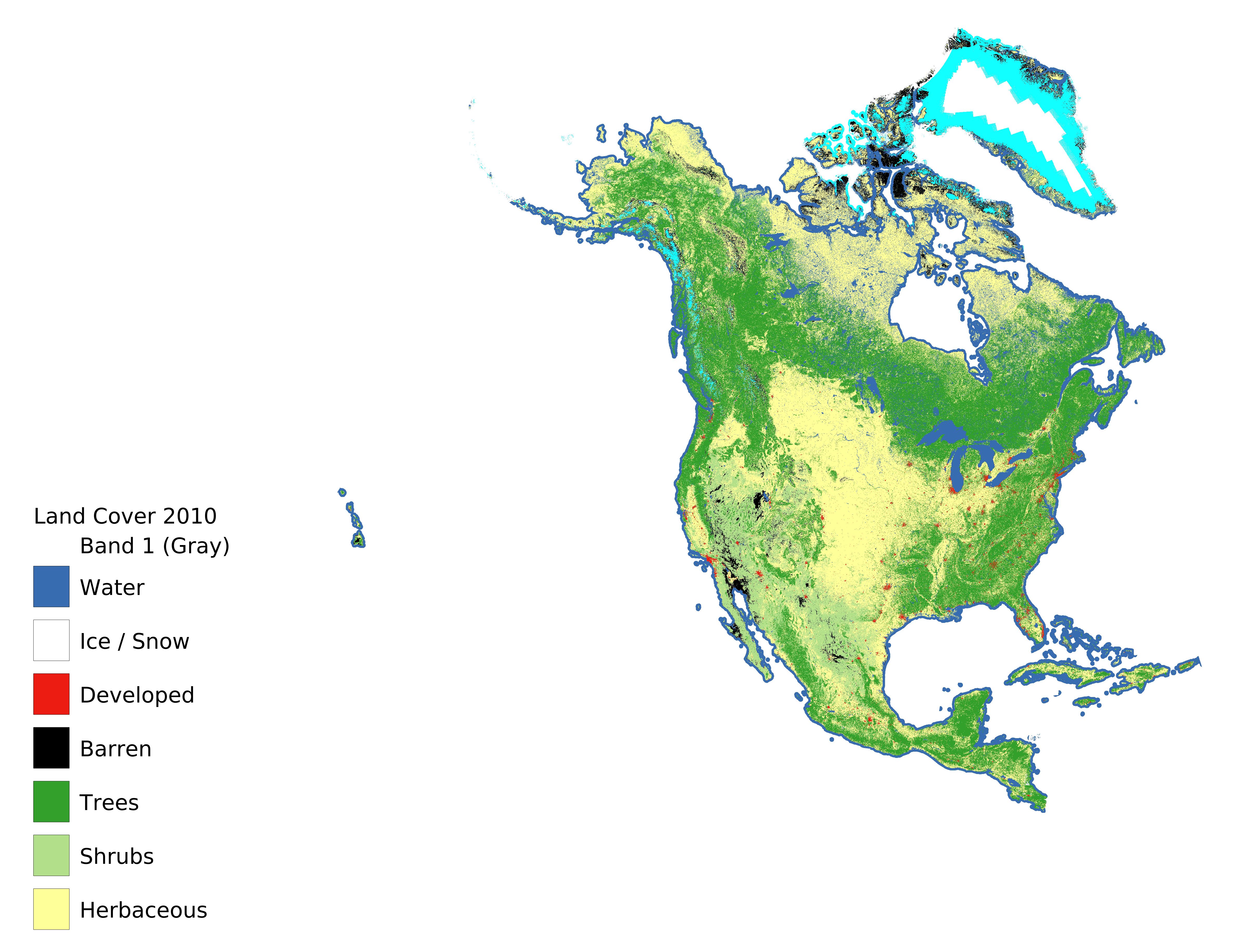
- It provides global time series of land cover, land use, and land cover change at annual time steps at 30-meter spatial resolution from 2001-2019
- It is produced using mature algorithms that are explicitly designed to identify land cover change and disturbance
- It includes robust quantification of accuracy and uncertainty
Access the GLanCE product here!
Below is a formal specification for the GLanCE data record.
The GLanCE land cover and land use classification is designed to support the broadest possible community of end-users who require high-quality information related to global land cover, land use, and land cover change.
The GLanCE data record includes data at 30-meter resolution, covers the period from 2001-2019 at annual time steps, and is distributed using the GLanCE tiling format. The GLanCE data is distributed as tiles with dimensions of 150 x 150 km, each tile being composed of 5,000 x 5,000 pixels (30-m resolution). GLanCE data products are provided using a set of seven continental grids that use a custom Lambert Azimuthal Equal Area projection parameterized to minimize distortion for each continent.
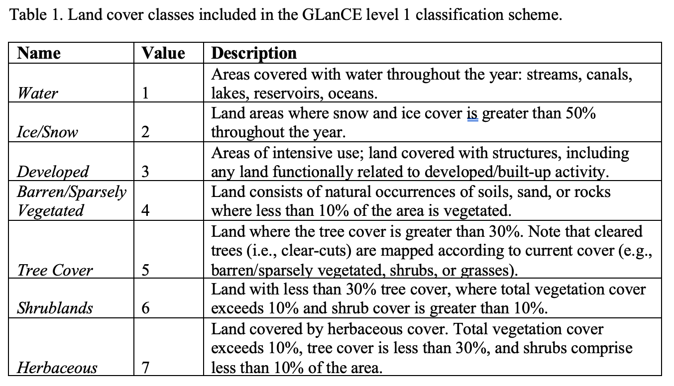
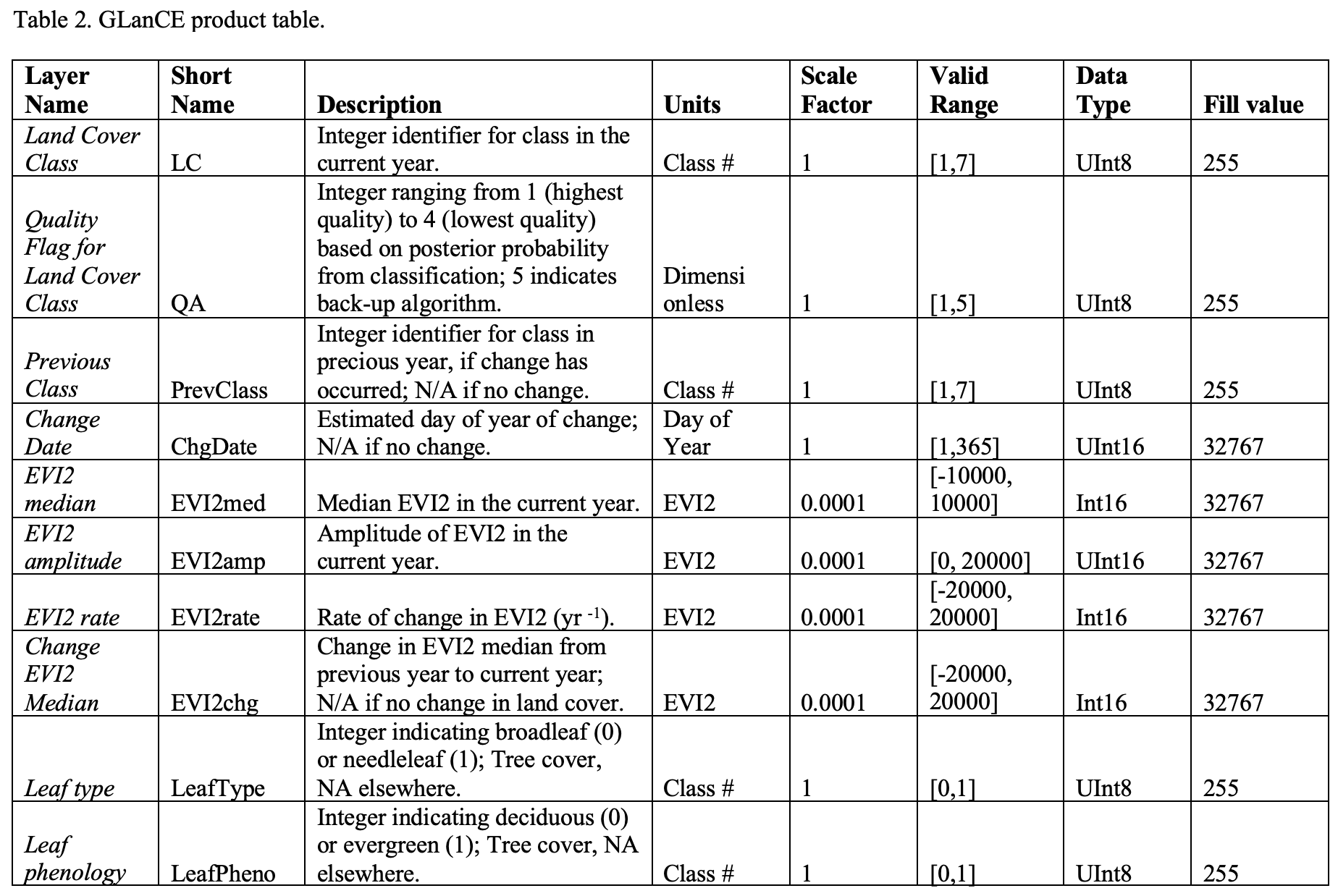
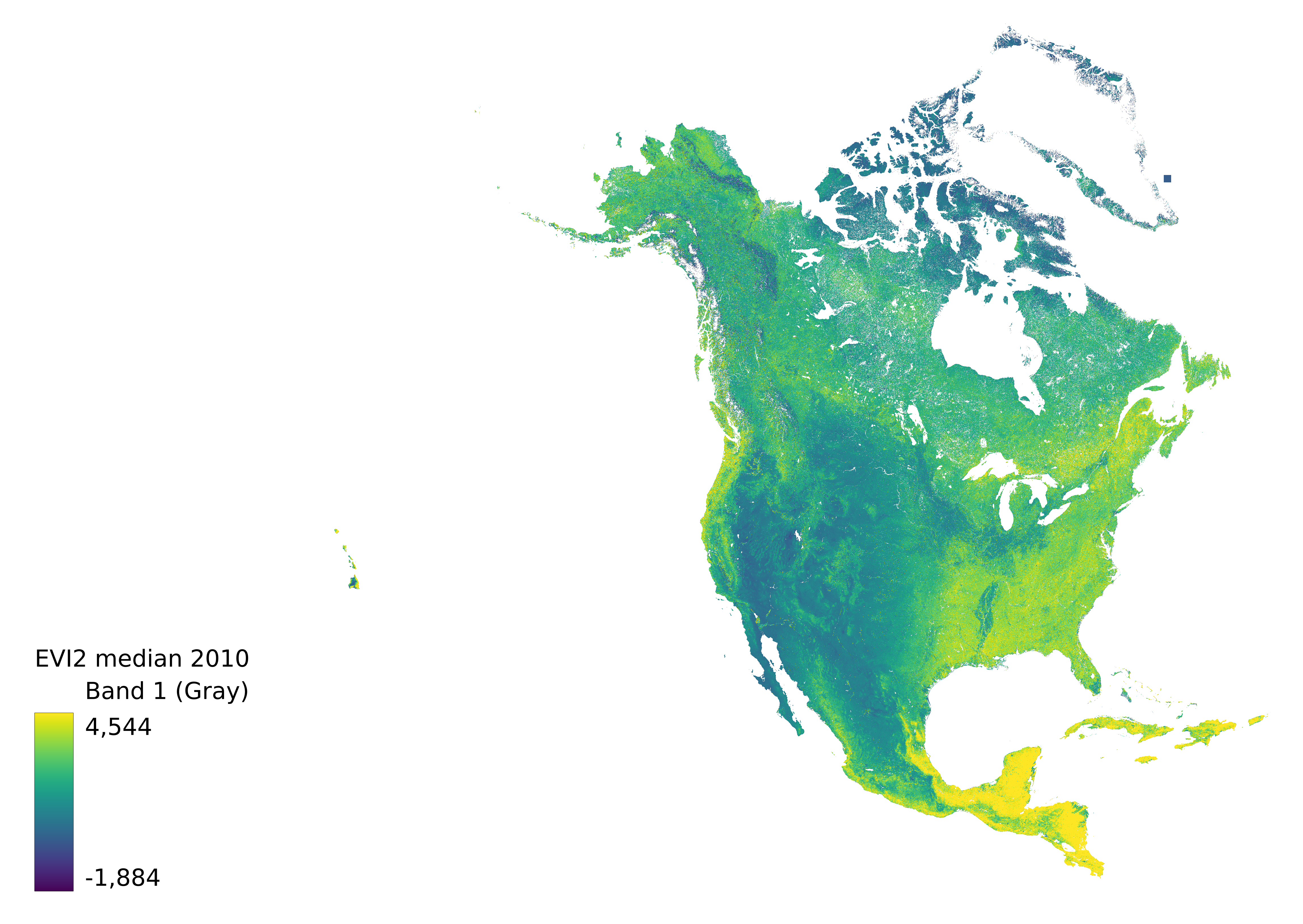
The 10 Science Data Sets (SDSs) included in the GlanCE product are described in Table 2. For all datasets, “current year” is defined as starting on July 2nd and ending on July 1st. Annual SDSs are calculated based on this time period and land cover SDS is reported for July 1st. Following this convention, a change that occurs in the current calendar (January 1st -July 1st) is assigned a change DOY less than or equal to 180, and a change that occurs in the previous calendar year (July 2nd to December 31st) is assigned a DOY greater than 180. Note that the V1.0 GLanCE data set is derived from Landsat Collection 1. Future versions of the data set will use Landsat Collection 2, which should improve the quality of the data set because of the improved geolocation and data density (in some regions) provided by Collection 2 data.
The GLanCE data product will be archived and is available from the Land Processes Distributed Active Archive Center (DAAC) at EROS Data Center.