Core Research Themes
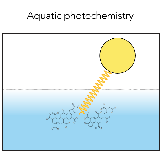

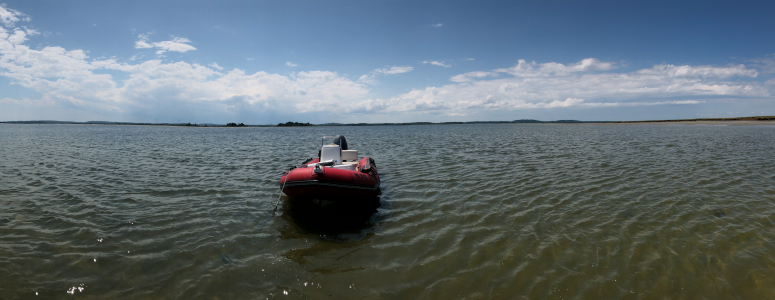
Aquatic photochemistry
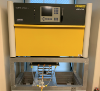
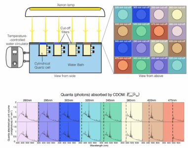
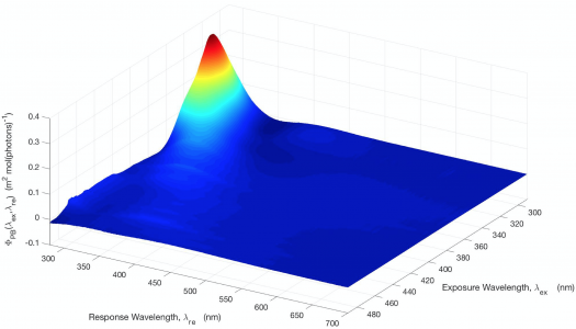
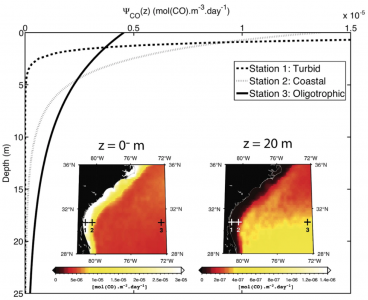
The absorption of high-energy solar radiation (e.g., ultraviolet-blue radiation) by chromophoric dissolved organic matter (CDOM) in the sunlit surface layer of natural waters triggers a suite of photochemical reactions leading to the oxidation, breakdown, and mineralization of dissolved organic matter and produces short-lived radicals and stable photoproducts of significance to marine and atmospheric processes and climate (e.g., CO2, CO, CH4, COS). This interaction with solar radiation enhances the cycling of refractory organic matter in aquatic systems. It also breaks down chromophores in CDOM (photobleaching) and affects the penetration of solar radiation in the water column, with consequences for the availability of photosynthetically available radiation to phytoplankton, UV exposure of the biota, and solar heating of surface waters. We work on quantifying these complex solar-induced processes through a combination of field data, laboratory-based experiments and analyses, and modeling informed by remote sensing in order to assess their local and global role and significance.
| Current Related Grants: | NASA Water Quality (80NSSC18K0344 ; PI Fichot) |
| Recent Related Publications: | Zhu et al. 2020 Li et al. 2020 |
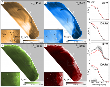
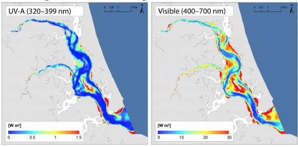
UV-visible imaging spectroscopy of inland and coastal waters
UV-visible imaging spectroscopy is an emerging and highly anticipated technology expected to facilitate the remote sensing of inland and coastal waters. Upcoming NASA satellite-borne missions, such as PACE: Plankton, Aerosol, Cloud, ocean Ecosystem and GLIMR: Geosynchronous Littoral Imaging and Monitoring Radiometer (and potentially SBG: Surface Biology and Geology), will feature imaging spectrometers capable of measuring the remote-sensing reflectance (Rrs) of water bodies at high spectral resolution across the visible range and well into the near-infrared and ultraviolet (UV) domains. Using data from airborne precursors (PRISM: Portable Remote Imaging SpectroMeter and AVIRIS-NG: Advanced Visible-InfraRed Imaging Spectrometer-Next Generation), we assess how these new spectral capabilities can help improve the remote sensing of water bodies and expand its range of applications for the monitoring of water quality and the study and modeling of biogeochemical and geophysical processes at the land-ocean interface.
| Current Related Grants: | NASA FINESST (80NSSC20K1648; PI Fichot ; GS Joshua Harringmeyer) NASA Earth Venture Suborbital-3 Program (NNH17ZDA001N-EVS3 ; Delta-X ; PI Simard) |
|
| Recent Related Publications: | Harringmeyer et al. (2021) Jensen et al. 2019 Thompson et al. 2019 Fichot et al. 2016 |
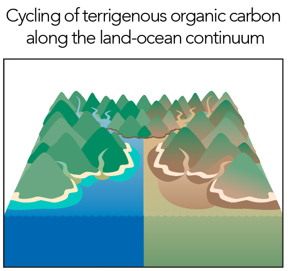
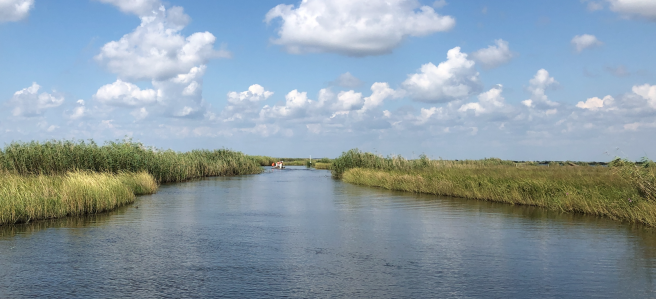
Cycling of terrigenous organic C along the land-ocean continuum
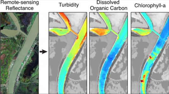
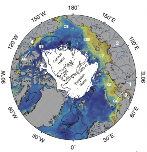
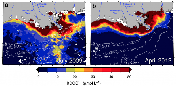
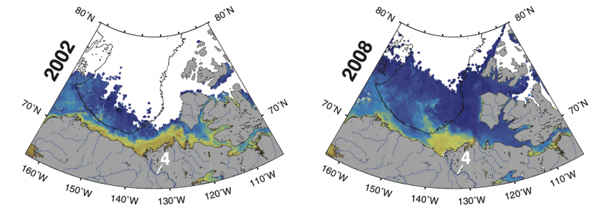
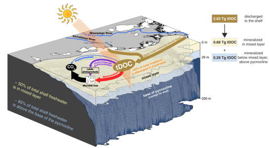
Rivers and tidal coastal wetlands represent major conduits by which large stocks of terrigenous organic carbon are transferred from terrestrial ecosystems to the ocean. In recent decades, terrestrial and marine ecosystems have experienced rapid changes in response to climate change and human activities (e.g., land cover change, wildfires, enhanced hydrology, permafrost thaw, water temperature, sea-ice melt), which in turn can have major impacts on both the mobilization of organic carbon from terrestrial environments and its subsequent processing along the land-ocean continuum. The question of how these conduits of organic carbon are responding to environmental change remains largely unanswered. Here, we work on integrating remotely sensed properties of the land and ocean, laboratory-derived quantities, and field-based measurements into modeling frameworks of the mobilization, transport and transformations of terrigenous organic carbon along the land-ocean continuum, in order to better quantify these conduits and evaluate their vulnerability to change.

| Current Related Grants: | NASA FINESST (80NSSC20K1648; PI Fichot ; GS Joshua Harringmeyer) NASA Water Quality Program (80NSSC18K0344; PI Fichot) |
|
| Recent Related Publications: | Fichot and Zhu (in progress) Zhu et al. 2020 Cao et al. 2018 Fichot and Benner 2014 |
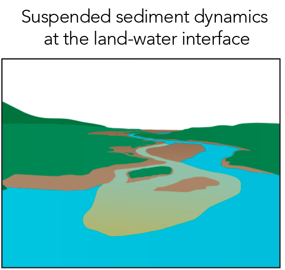
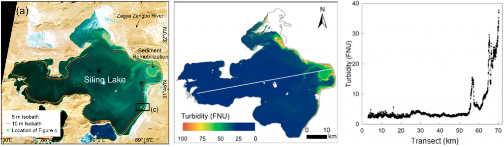
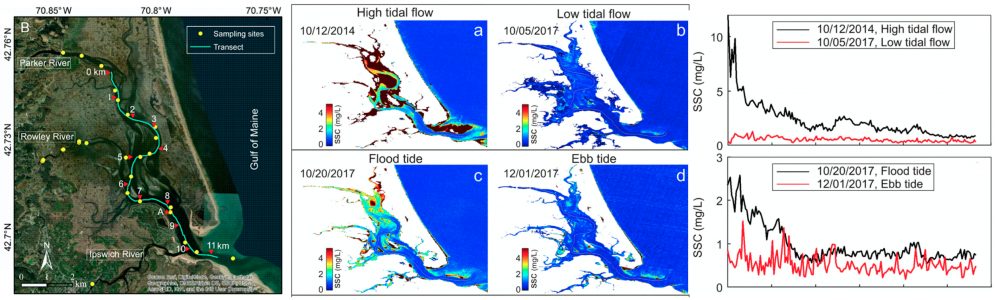
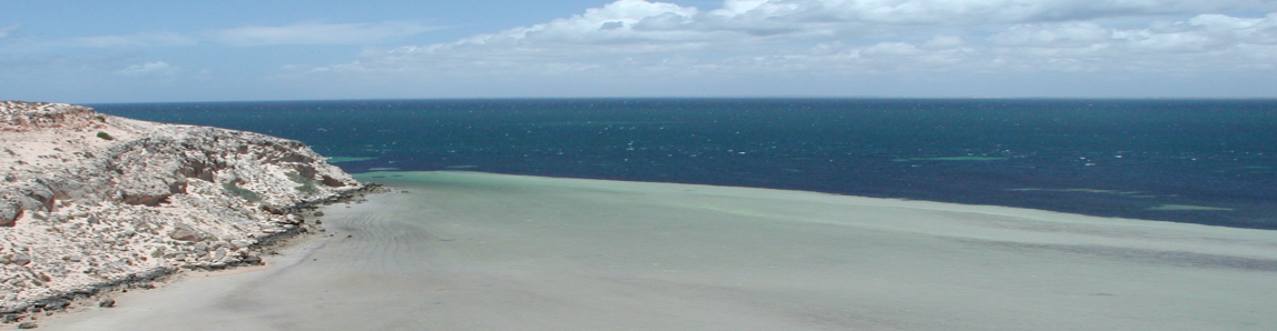
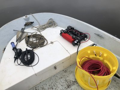
Suspended sediment dynamics at the land-water interface
The dynamics of suspended sediment at the land-water interface are critically important to the short- and long-term evolution of the coastal landscape and play a major role regulating the water quality (e.g., turbidity, transparency) of estuarine and coastal waters. Understanding the mechanisms regulating the supply and redistribution of suspended sediments in and around river deltas, salt marshes, and mangroves and how they are changing are key to determining the vulnerability and resiliency of these environments to human- and climate-driven changes (e.g., rising sea-level, land subsidence, increased storminess, damming, etc…). We leverage remote sensing, field and lab-based measurements, and models to study the dynamics of suspended sediments at the land-water interface, understand its drivers, and determine their vulnerability and resiliency to environmental change.

| Current Related Grants: | NASA Earth Venture Suborbital-3 Program (NNH17ZDA001N-EVS3 ; Delta-X ; PI Simard) | |
| Recent Related Publications: | Fichot et al. (in progress) Mi et al. 2020 Balasubramanian et al. 2020 Zhang et al. 2020 Mi et al. 2019 |
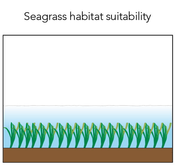
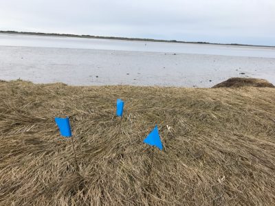
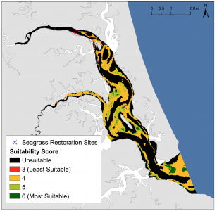
Seagrass habitat suitability
Seagrass meadows provide important ecosystem services, including the sequestration of >80 million metric tons of organic carbon annually (blue carbon), and are therefore important assets worth preserving to mitigate the anthropogenic impacts on climate. Unfortunately, the abundance and distribution of seagrasses are declining rapidly worldwide due to growing anthropogenic pressures. Major seagrass restoration efforts have been made in recent years to help mitigate this decline, and habitat suitability models are often used to determine suitable restoration sites and guide these efforts. Solar exposure of the seagrass beds is one of the primary determinant of suitability but is often inadequately included in these models. We combine modeling, field optics, and remote sensing to determine the optimal benthic solar exposure conditions for seagrasses in dynamic, heterogeneous shallow coastal environments and help improve habitat suitability models and guide restoration efforts there.
| Current Related Grants: | … |
| Recent Related Publications: | Cronin-Golomb et al. (2021) |