Inventory

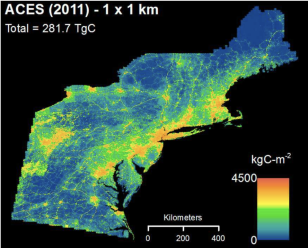
Existing national and global inventories of fossil fuel carbon dioxide (FFCO2) emissions do not directly quantify emissions at local scales, instead using spatial proxies to downscale emissions based on national totals. The growing availability of open-source government data, and the maturation of methodologies for constructing large, high-resolution models of emissions, open the possibility to develop a national carbon emissions inventory with the detail and fidelity needed to assess regional mitigation efforts. For this synthesis effort, we will take the methods, code, and approaches from our ACES-NE emissions inventory and our national DARTE on-road emissions product to build a new national inventory for 2015~2016, with hourly, sector-specific emissions at high spatial resolution (0.01° / 1 km2). This data product will provide harmonized, consistent estimates of FFCO2 emissions at high resolution for U.S. urban regions, based on publicly available datasets. We will estimate CO2 emissions associated with oil and gas production within our new national ACES inventory.

We will synthesize the many recent improvements made in urban-scale and regional bottom-up inventories and will provide a benchmark for evaluating existing and future high-resolution inventories. The new inventory will be compared to existing global data sets to identify sources of uncertainty and quantify errors in these widely-used emissions estimates for urban domains. We will also use the new inventory to test the sensitivity of regional atmospheric inversion models to various emissions priors used (year, data sources, methods of construction, source sectors included, spatial and temporal resolution).
Key Contact: Conor Gately (cgately at gmail.com)