Coastal Vulnerability in the Merrimack River Watershed
Project Partner: Dr. Danielle Perry (Coastal Resilience Program Director), Mass Audubon, Summer 2021
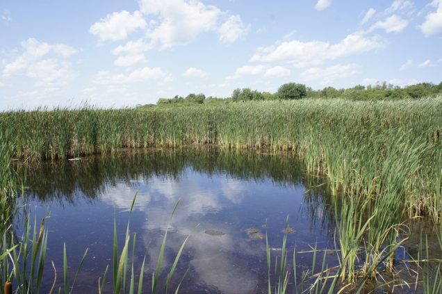
Project Summary: Sea level rise impacts coastal communities by threatening both infrastructure and natural habitats. Coastal saltwater marshes protect communities from storm surges and flood events, but pollution (especially excess nutrient loading) can lead to marsh degradation and habitat loss. Sarah partnered with Dr. Danielle Perry of Mass Audubon to examine this problem at the mouth of the Merrimack River to contribute toward a coastal vulnerability assessment. Ongoing research at Mass Audubon investigates the potential downstream effects of nutrient loading on coastal marsh resiliency.
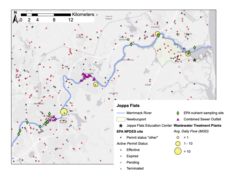
Sarah generated maps of potential sources of excess nutrients along the banks of the Merrimack River, such as wastewater treatment plants, combined sewer outfalls, and permitted nutrient discharge sites in order to improve Mass Audubon’s data collection strategies. Seeking ways to apply the research findings, she identified future collaborative opportunities between Mass Audubon and local municipalities through the Massachusetts Municipal Vulnerability Preparedness (MVP) Program. Sarah also analyzed data from the Mass Audubon’s Salt Marsh Science Project, a high school program that monitors plant growth and other conditions in salt marshes. She developed code, maps, and other data products for Mass Audubon’s continued use as they work to maintain critical habitats and collaborate with local municipalities.
Project Deliverables:
- “Collaborative opportunities between Mass Audubon & Municipality Vulnerability Preparedness plans along the Merrimack River” (download here)
- Map (below) of potential sources of excess nutrients in the Merrimack River in Massachusetts, such as wastewater treatment plants, combined sewer outfalls, and permitted nutrient discharge sites (EPA NPDES). The town of Newburyport (outlined), the Joppa Flats Education Center (grey star), and EPA nutrient sampling sites (green diamonds) are also noted. This map can be used to guide a sampling regime to determine how nutrient point sources affect coastal habitat degradation and resiliency in the mouth of the Merrimack River.
Hear more about Sarah’s internship from her lightning talk during our Fall 2021 Intro Workshop!