Natural Cults Project: Visualizing the Greek Landscape in the Argolid and Messenia (c. 2600 BCE-146 BCE)
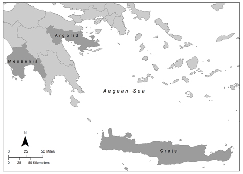
My project seeks to understand the relationship between Greek cultic places and natural features, specifically whether the cultic place was located in proximity to or within the sight of a particular natural feature. In order to understand these relationships, I am implementing a large-scale investigation of previously identified cultic places in the Argolid and Messenia (Peloponnese, Greece). Multiple forms of evidence will be referenced, including textual, archaeological, and visualization data.
Visualization data will include Google Earth simulated fly-throughs and terrain shots, photographs and videos taken in the field, as well as visualscapes developed in ArcScene and GRASS GIS. Visualscape models will include the total and cumulative viewshed, visual prominence, and visual exposure (Llobera 2003: 31-40). Each of these models will help to measure and simulate the visual impact of a particular natural feature on its surroundings (Llobera 2003: 31). All forms of data will be compiled into a database, enabling the user to isolate various attributes of interest, such as time period, structure type, and type of related natural feature.
CONTACT — Natalie Susmann, nsusmann@bu.edu


