Introduction
 This research uses ground-based, upward-scanning hemispherical lidar to retrieve forest canopy structural information, including tree height, mean tree diameter, basal area, stem count density, crown diameter, woody biomass, and green biomass, and links this information to airborne and spaceborne lidars to provide large-area mapping of structural and biomass parameters.
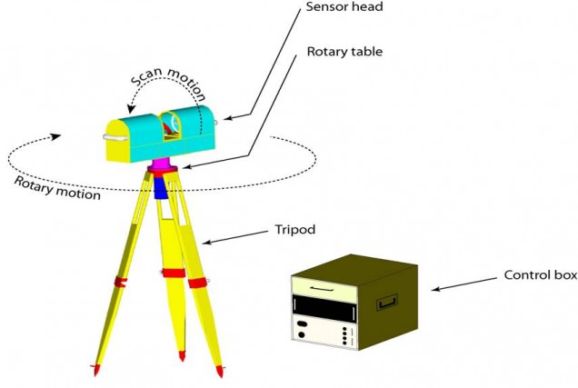
The terrestrial lidar instrument, Echidna®, developed by CSIRO Australia, allows rapid acquisition of vegetation structure data that can be readily integrated with downward-looking airborne lidar, such as LVIS (Laser Vegetation Imaging Sensor), and spaceborne lidar, such as GLAS (Geoscience Laser Altimeter System) on ICESat.
Lidar waveforms and vegetation structure are being linked for these three sensors through the hybrid geometric-optical radiative-transfer (GORT) model, which uses basic vegetation structure parameters and principles of geometric optics, coupled with radiative transfer theory, to model scattering and absorption of light by collections of individual plant crowns. Use of a common model for lidar waveforms at ground, airborne, and spaceborne levels facilitates integration and scaling of the data to provide large-area maps and inventories of vegetation structure and carbon stocks.
First-generation algorithms for processing Echidna® data focus on retrieving the location, size, and spacing of tree trunks and on the foliage profile of the stand. To the right are some early results for eight sites arranged in a 200-m square centered on a flux tower near Tumbarumba, New South Wales, Australia. The location is a eucalypt woodland with an overstory of large, old trees and a younger, lower canopy layer of smaller trees and shrubs.
