
Data Sharing
Gately, C.K., Hutyra, L.R., Sue Wing, I., Brondfield, M.N., A bottom-up approach to on-road CO2 emissions estimates: improved spatial accuracy and applications for regional planning. Environmental Science and Technology 47(5), 2423–2430, 2013. PDF

Gately HPMS Emissions 1 km (zipped csv files); Gately HPMS Emissions 1 km (zipped geodatabase); Gately read me (txt file)
Raciti, S.M., Hutyra, L.R., Newell, J.D. Mapping carbon storage in urban trees with multi-source remote sensing data: Relationships between biomass, land use, and demographics in Boston neighborhoods. Science of the Total Environment, in press (DOI: 10.1016/j.scitotenv.2014.08.070). PDF
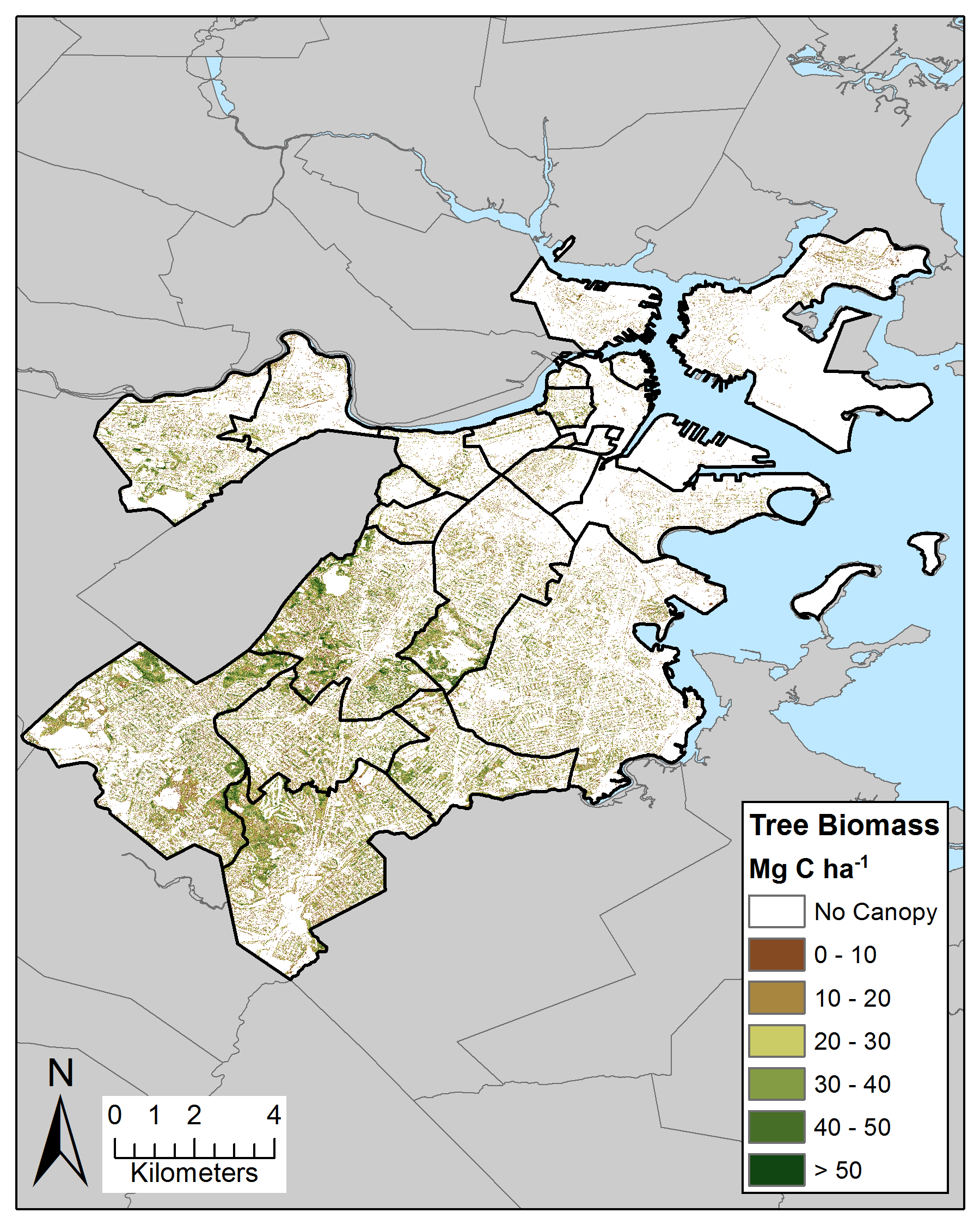

Raciti Boston Biomass (zipped GRID raster); Raciti Boston Canopy Cover (zipped GRID raster); Raciti biomass and canopy cover read me (docx file)
Fair Use Policy:
The data contained on this site is freely available and we encourage others to use it. Kindly keep us informed of how you are using our data and of any publication plans. If we feel that we should be offered participation as authors, we will let you know and we assume that an agreement on such matters will be reached prior to attempting to publish the data. If your work directly competes with our analysis we may ask that we have the opportunity to submit a manuscript before you submit one that is heavily based on our unpublished data. These data may be updated or reprocessed from time to time, and it is your responsibility to insure that your publication contains the most recent revision of the data.
In order to maintain these measurements we periodically need to demonstrate progress to our sponsoring agencies. In addition to informing us of your plans, we kindly request that you help us by providing pre-prints and updates on publication status.
By downloading this data, you agree to the terms of our fair use policy.